-
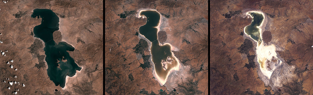
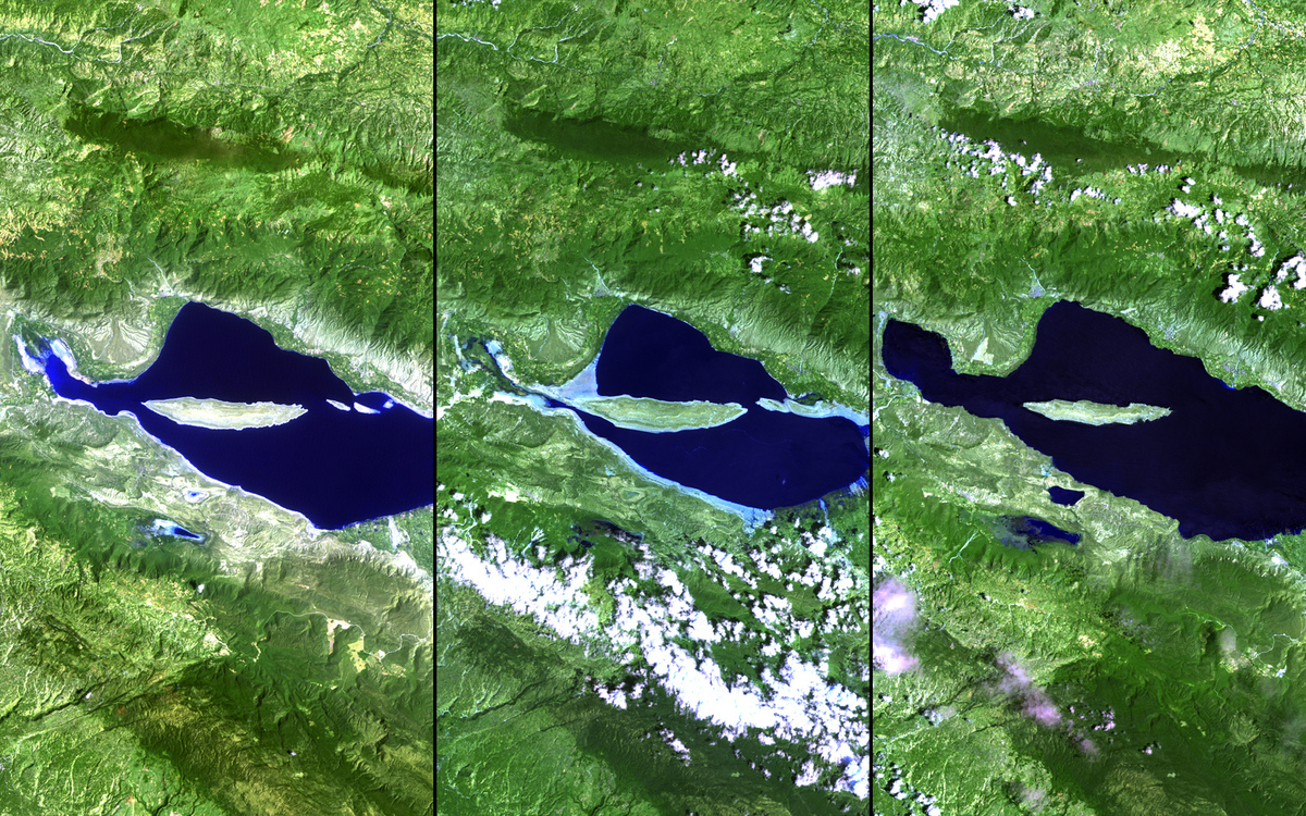
Lake Urmia Iran (2000-2014)
 U.S. Geological Survey (USGS) Landsat Missions Gallery “Lake Urmia 2000-2013,” U.S. Department of the Interior / USGS and NASA. hide creditsdownload image
-
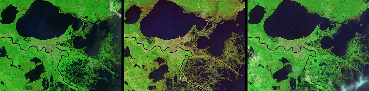
Passaggio uragano Katrina, New Orleans
 NASA Earth Observatory
-
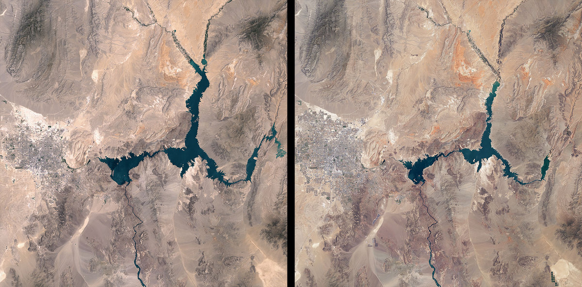
Lago Mead, Nevada/Arizona
 NASA Earth Observatory
-
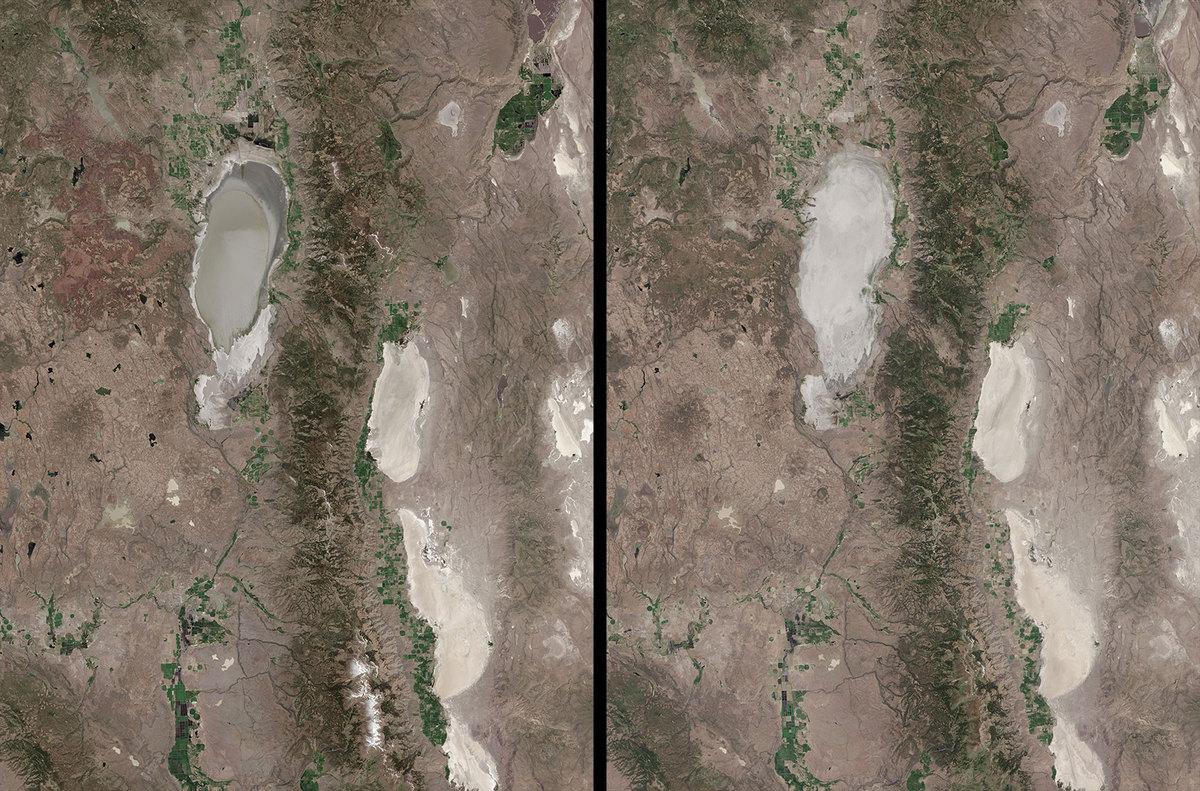
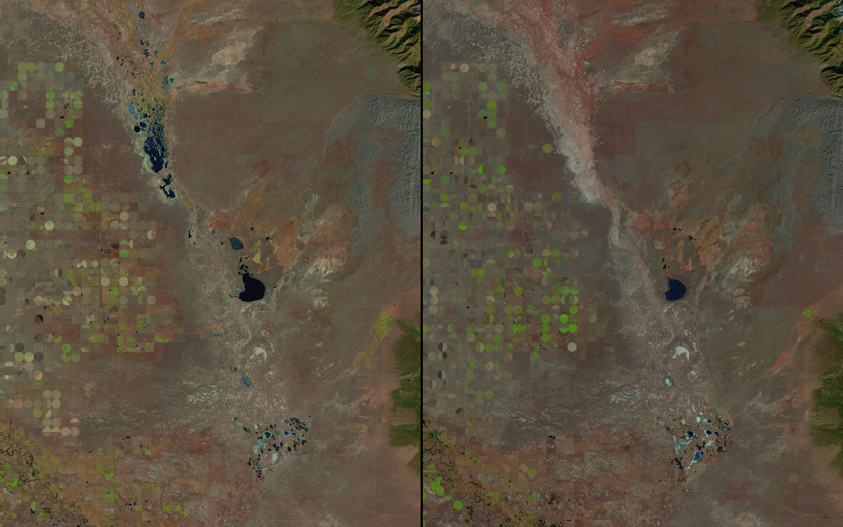
Goose Lake, California/Oregon (2013-2015)
 NASA Earth Observatory
-
Nairobi Kenya
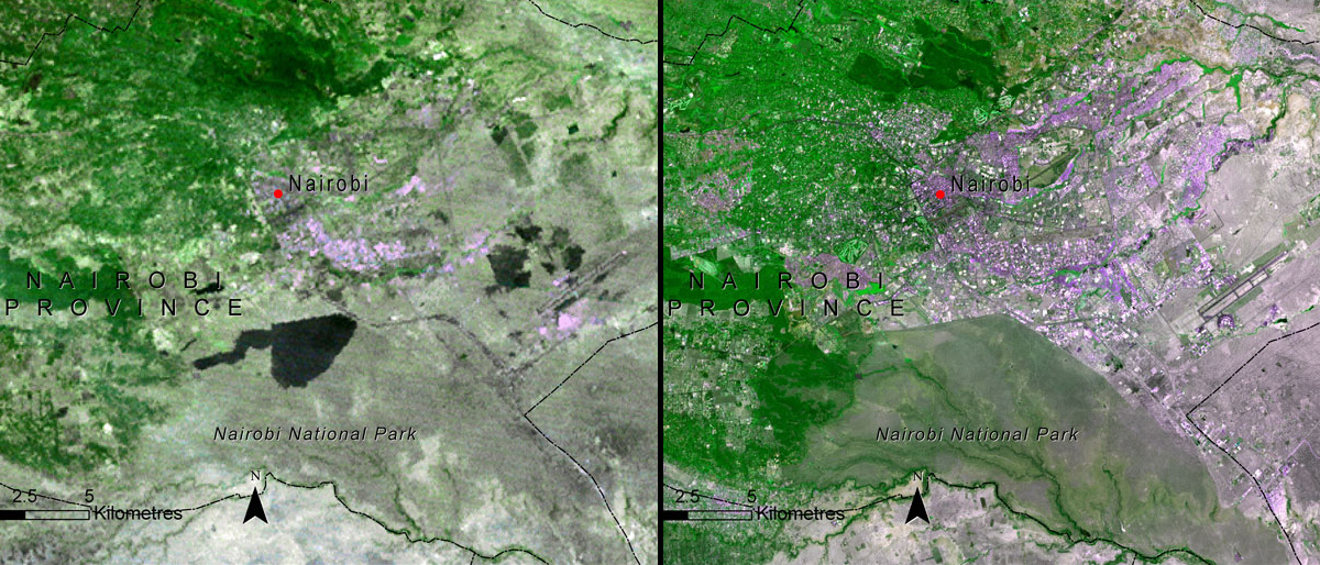 United Nations Environment Programme (UNEP). From Kenya Atlas of our Changing Environment (2009); Division of Early Warning and Assessment (DEWA), UNEP, Nairobi, Kenya
-
Great Sand Dunes
 U.S. Geological Survey (USGS) Landsat Missions Gallery “The Great Sand Dunes National Park,” U.S. Department of the Interior / USGS and NASA.
-
Ghiacciaio Mýrdalsjökull, Islanda
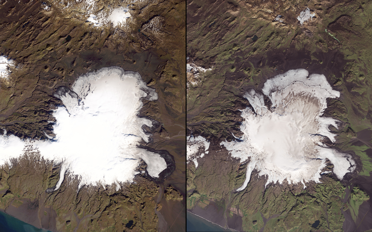 NASA Earth Observatory, using data from the U.S. Geological Survey.
-
Ghiacciaio Columbia, Alaska
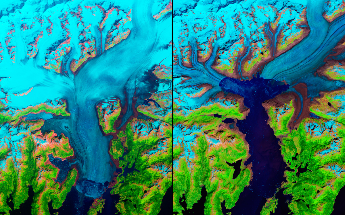 NASA Earth Observatory, using data from the U.S. Geological Survey.
-
Dubai Islands
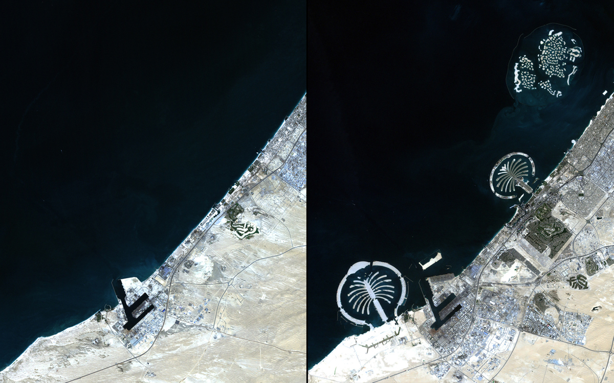 U.S. Geological Survey (USGS) Landsat Missions Gallery “Dubai’s Islands,” U.S. Department of the Interior / USGS and NASA
-
Cuesta del Viento, Argentina
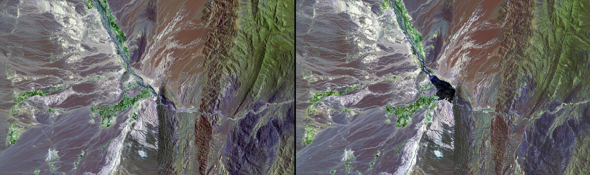 U.S. Geological Survey (USGS) Landsat Missions Gallery “Cuesta del Viento Reservoir,” U.S. Department of the Interior / USGS and NASA.
-
Delta Fiume Giallo, Cina (1985 – 2014)
 U.S. Geological Survey (USGS) Landsat Missions Gallery “Huang He Delta and Lauzhou Bay,” U.S. Department of the Interior / USGS and NASA
-
Inondazione Francia
 U.S. Geological Survey (USGS) Landsat Missions Gallery “Effects of Flooding: Hyères, France,” U.S. Department of the Interior / USGS and NASA.
-
Ghiacciaio, Yosemite National Park ( 2009 – 2014)
 U.S. National Park Service
-
Lago d’Aral, Uzbekistan/Kazakistan
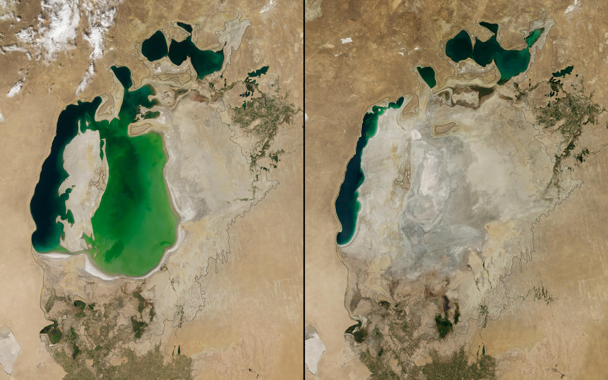 NASA’s Earth Observatory
-
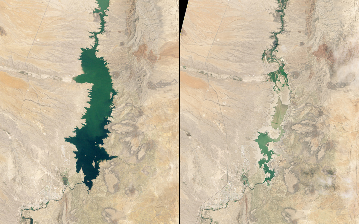
Lake Powell (1999-2015)
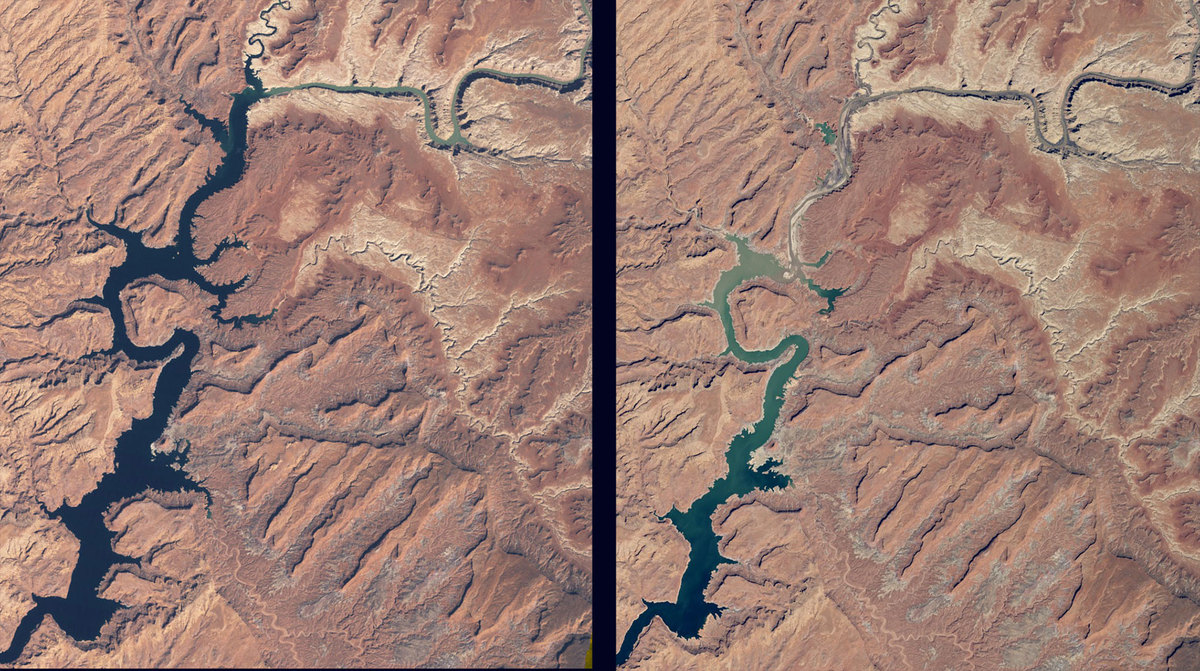 NASA’s Earth Observatory
-
Incendi California
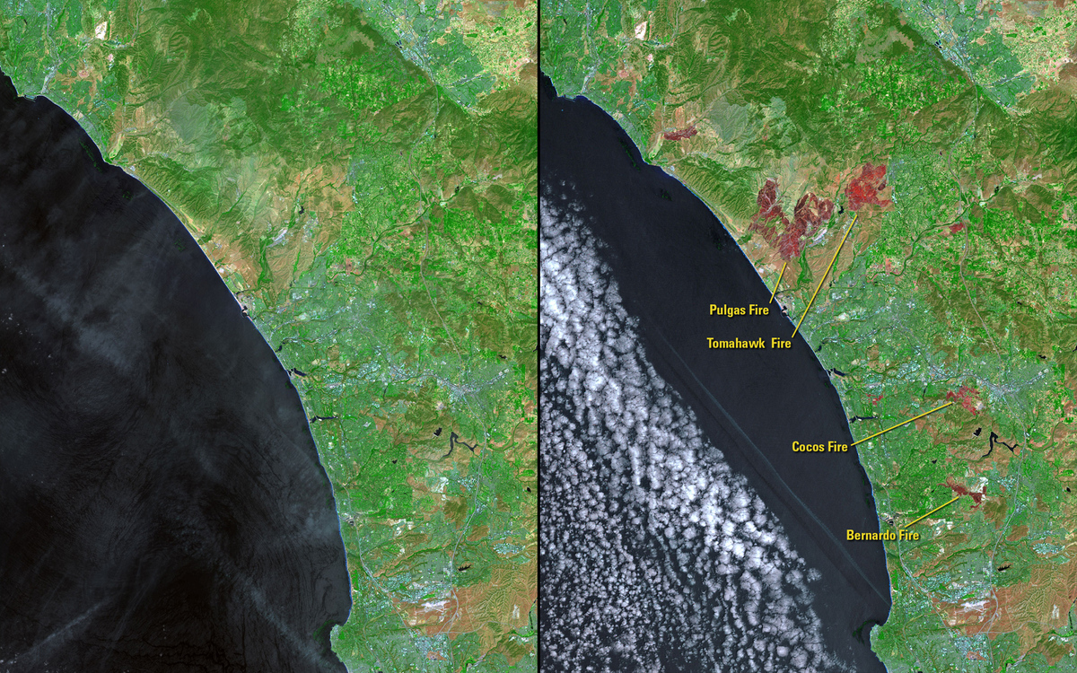 U.S. Geological Survey (USGS) Landsat Missions Gallery “Fires in California, USA,” U.S. Department of the Interior / USGS and NASA.
-
Siccità in California
 U.S. Geological Survey (USGS) Landsat Missions Gallery “Drought Conditions in California, USA,” U.S. Department of the Interior / USGS and NASA.
-
Riserva Elephant Butte, New Mexico
 NASA Earth Observatory
-
Incendi Australia
 Earthshots: Satellite Images of Environmental Change, “Wyperfeld National Park,” U.S. Geological Survey.
-
Singapore
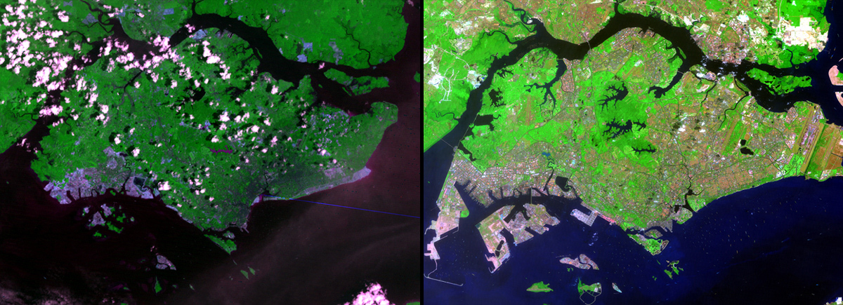 Earthshots: Satellite Images of Environmental Change, “Singapore,” U.S. Geological Survey.
-
Tifone Nari, Cambogia
 U.S. Geological Survey (USGS) Landsat Missions Gallery “Flooding in Cambodia,” U.S. Department of the Interior / USGS and NASA.
-
Diga Mirani, Pakistan
 U.S. Geological Survey (USGS) Landsat Missions Gallery “Mirani Dam,” U.S. Department of the Interior / USGS and NASA.
-
Fiume Agno dopo tifone Haiyan, Filippine
 Operational Land Imager onboard Landsat 8 and the Enhanced Thematic Mapper Plus onboard Landsat 7
-
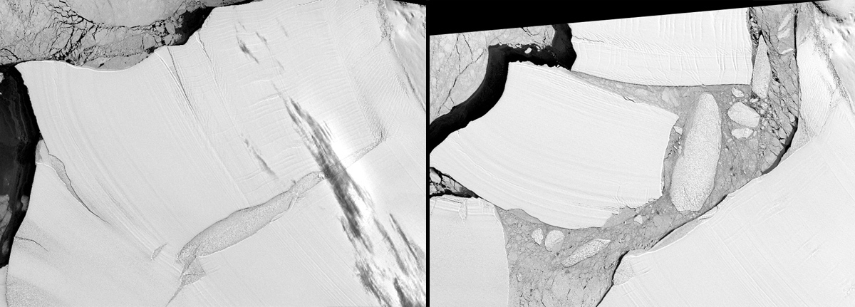
Ghiacciaio Pine Island
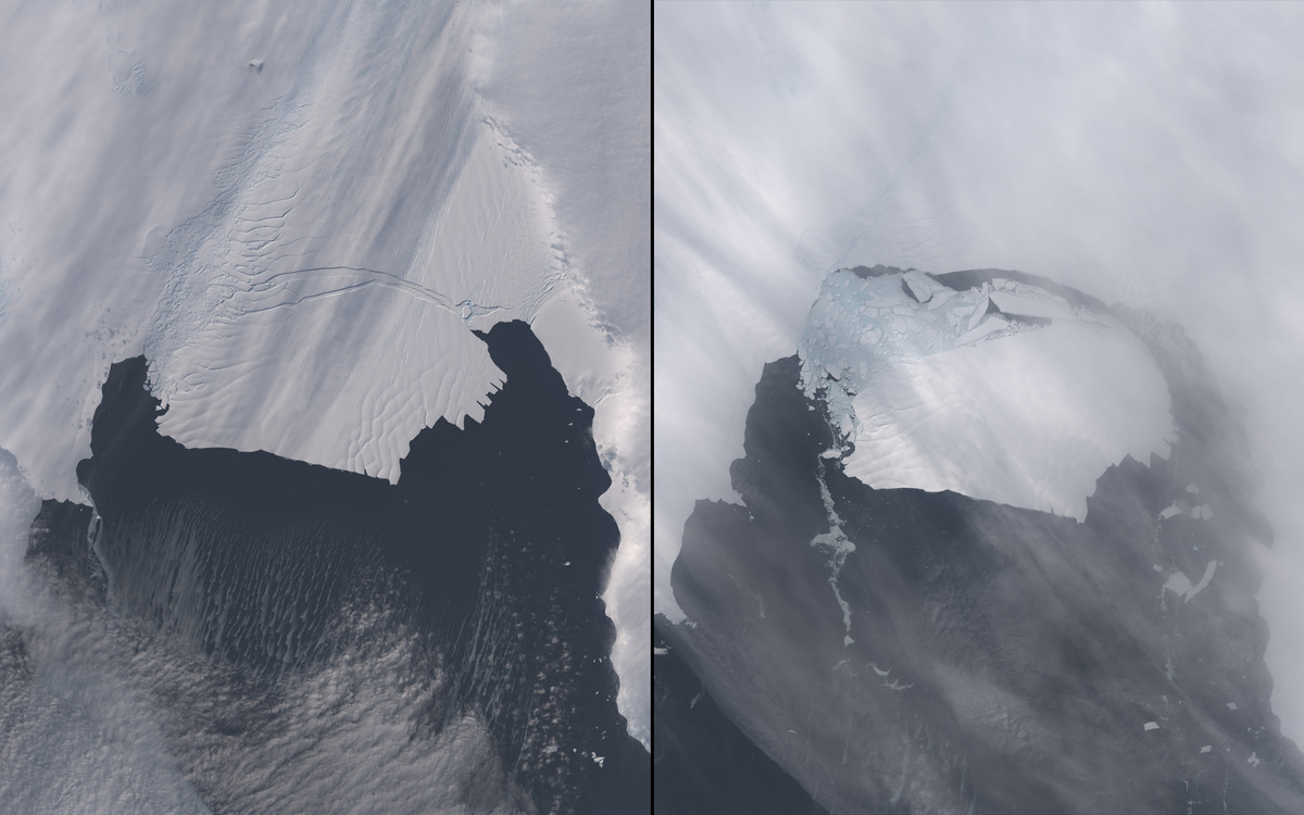 NASA Earth Observatory
-
Incendi Alaska
 U.S. Geological Survey (USGS) Landsat Missions Gallery “Fires Scar Alaskan Landscape,” U.S. Department of the Interior / USGS and NASA.
-
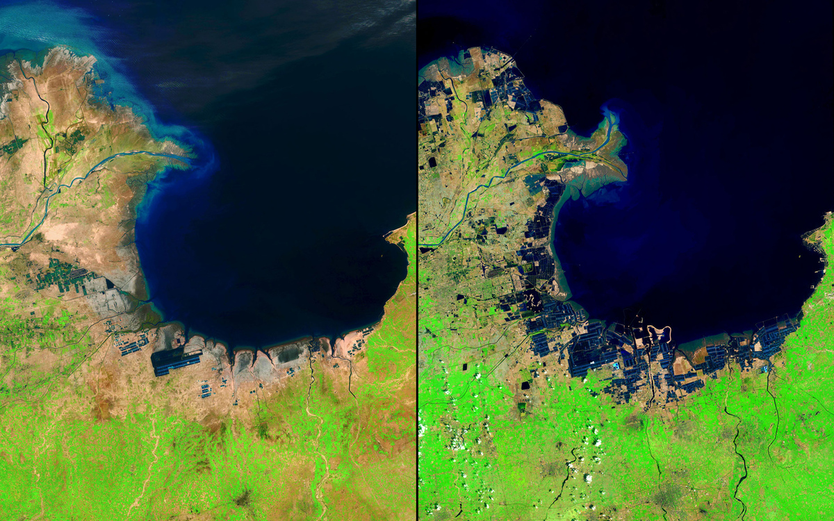
Lago Chapala, Messico
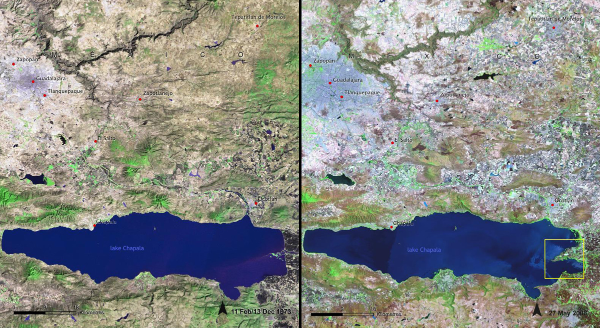 United Nations Environment Programme (UNEP) From Latin America and the Caribbean Atlas of our Changing Environment (2010).
-
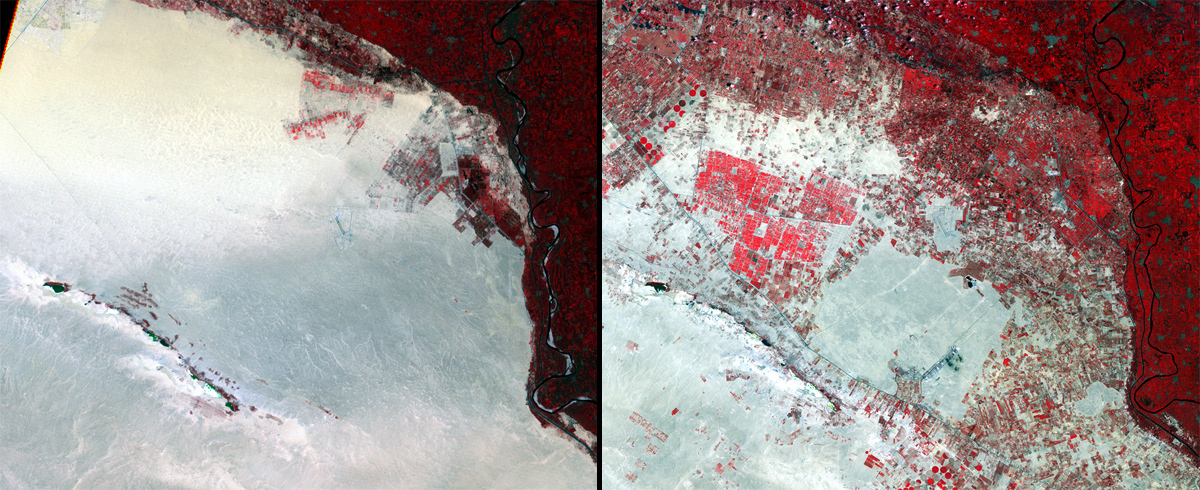
Giacimenti Texas
 U.S. Geological Survey (USGS) Landsat Missions Gallery “Texas Oil Field Expansion, 1984 to 2013,” U.S. Department of the Interior / USGS and NASA.
-
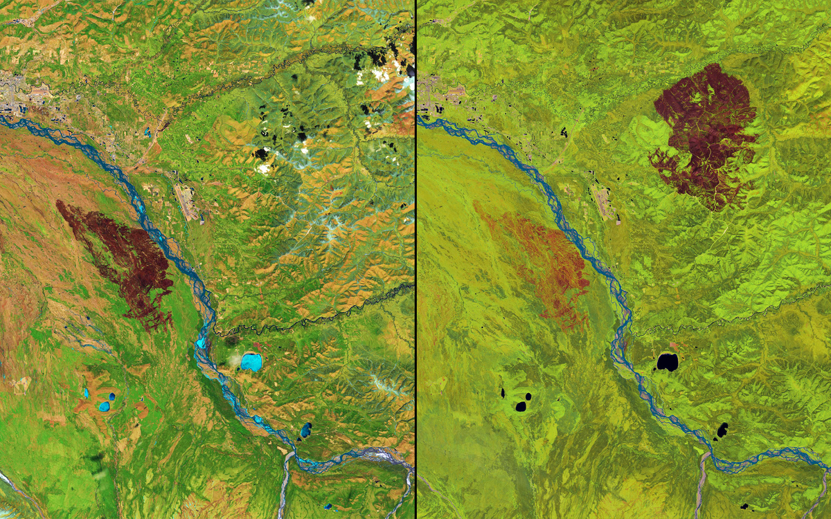
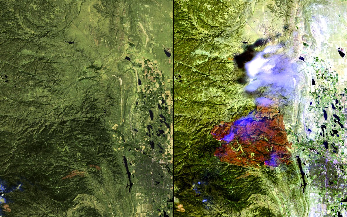
Incendio Colorado
 U.S. Geological Survey (USGS) Landsat Missions Gallery “Black Forest Fire,” U.S. Department of the Interior / USGS and NASA.
-
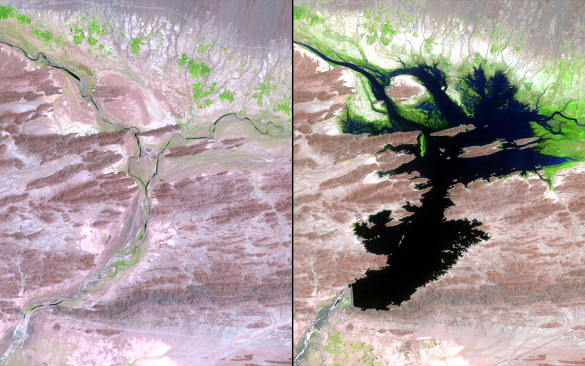
Bahr al Milh, Iraq
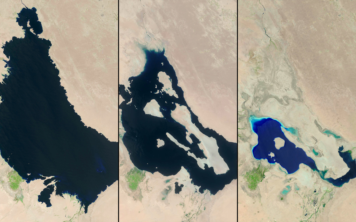 U.S. Geological Survey (USGS) Landsat Missions Gallery “Bahr al Milh,” U.S. Department of the Interior / USGS and NASA.
-
Penisola artificiale Canada
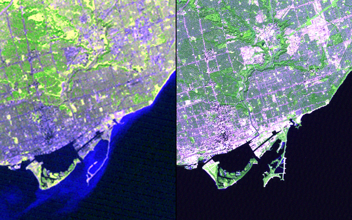 U.S. Geological Survey (USGS) Landsat Missions Gallery “Leslie Street Spit and Tommy Thompson Park,” U.S. Department of the Interior / USGS and NASA.
-
Incremento agricoltura Nilo
 Earthshots: Satellite Images of Environmental Change, U.S. Geological Survey.
-
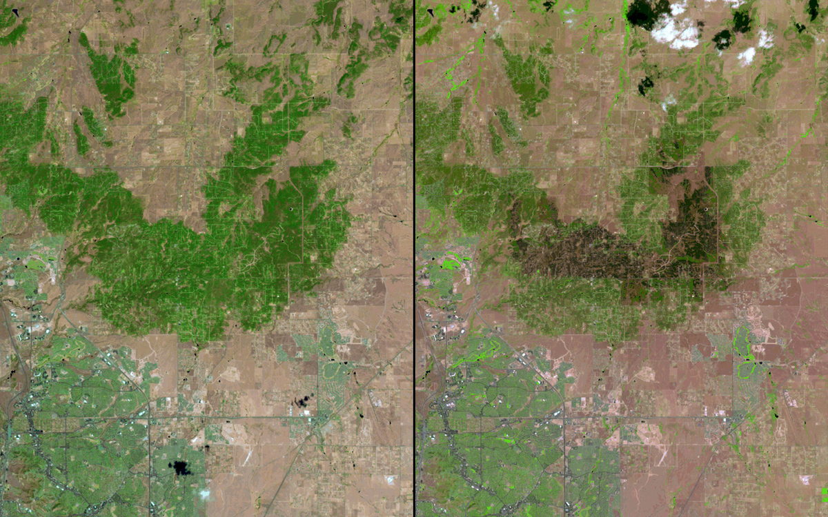
High Park incendio
 U.S. Geological Survey (USGS) Landsat Missions Gallery “High Park Fire, Colorado – June 2012,” U.S. Department of the Interior / USGS and NASA, and denverpost.com
-
Frana Washington
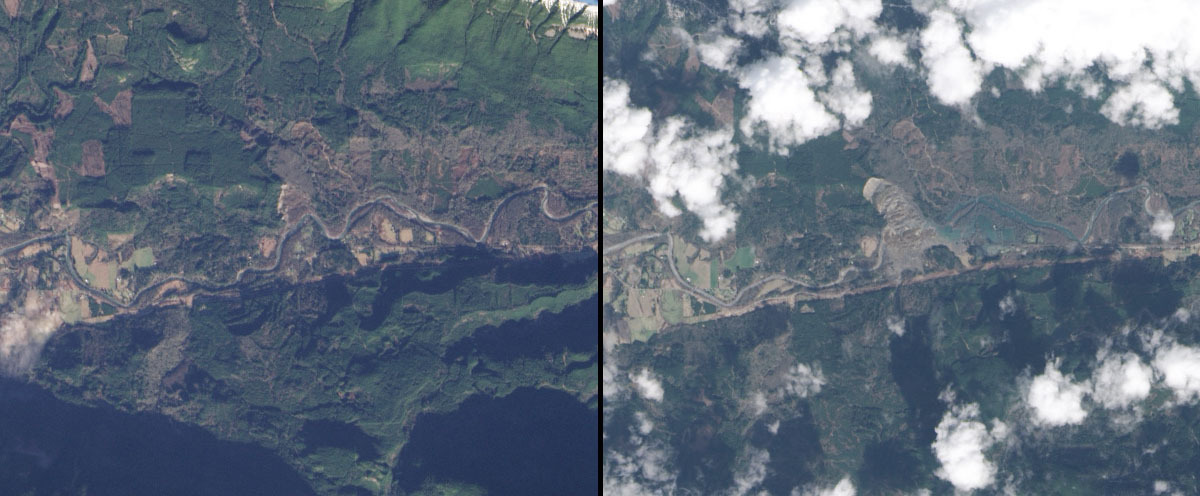 NASA Earth Observatory
-
Crescita urbanistica, Sud Corea
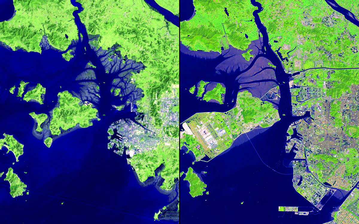 U.S. Geological Survey (USGS) Landsat Missions Gallery “32 Years of Change: Incheon, South Korea,” U.S. Department of the Interior / USGS and NASA.
-
Lago Urmia, Iran
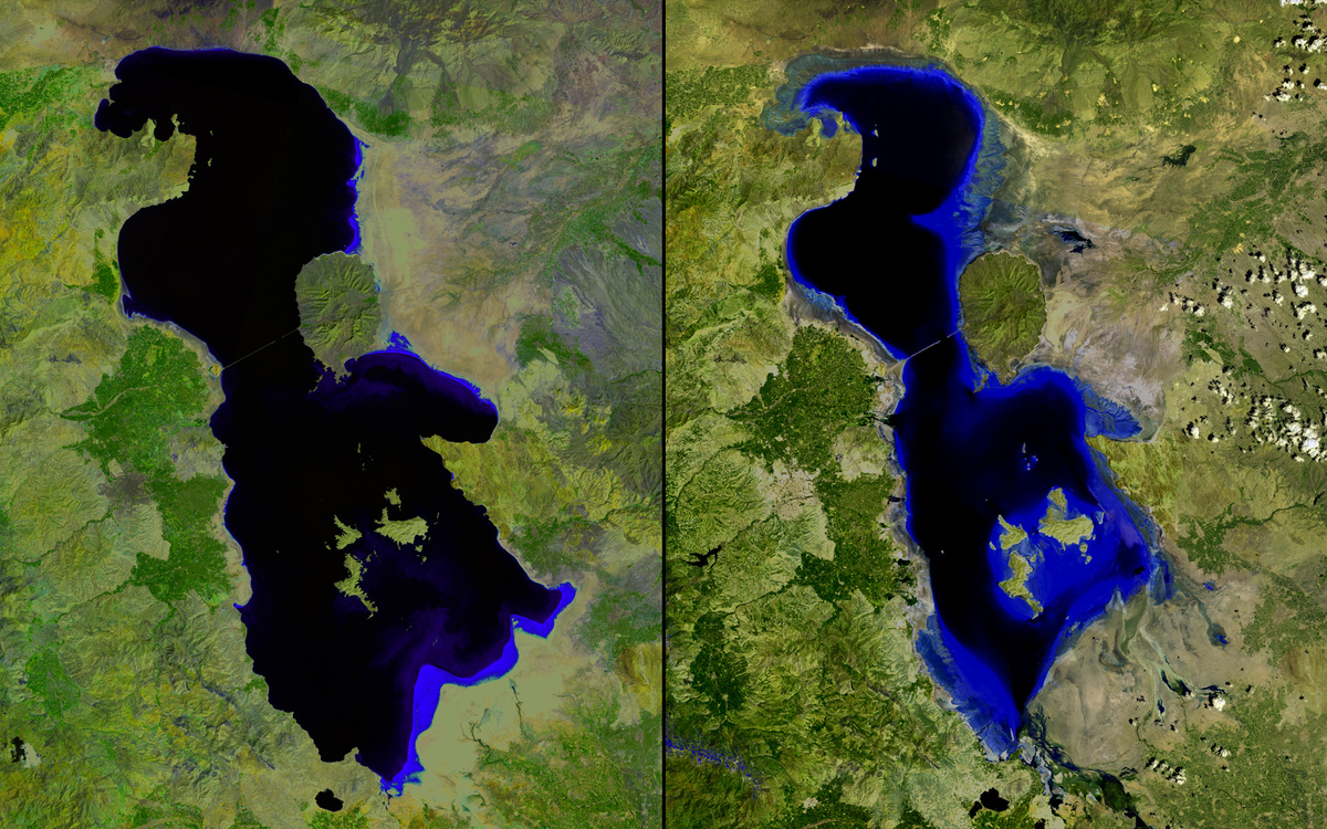 U.S. Geological Survey (USGS) Landsat Missions Gallery “Lake Urmia 2000-2013,” U.S. Department of the Interior / USGS and NASA.
-
Desertificazione Mauritania
 : Earthshots: Satellite Images of Environmental Change, “Rosso, Mauritania Desertification,” U.S. Geological Survey.
-
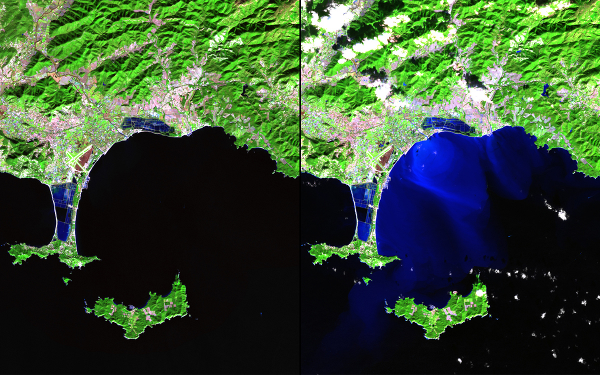
Delta del Fiume delle Perle, Cina
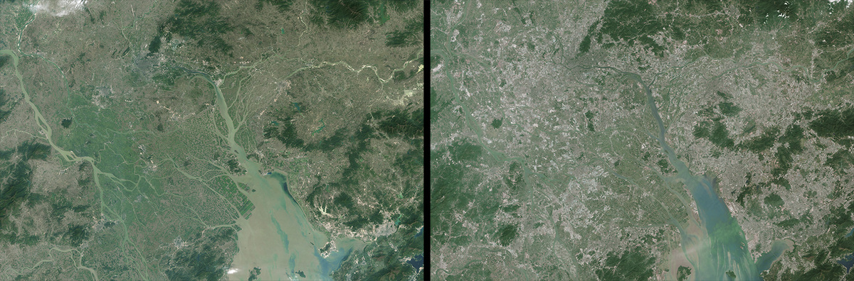 Images taken by the Thematic Mapper sensor onboard Landsat 5 and the Operational Land Imager onboard Landsat 8
-
Alluvione Death Valley, California
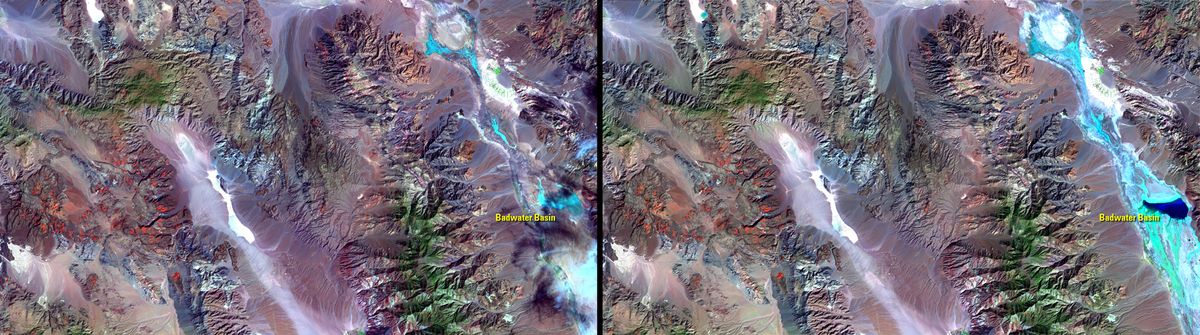 U.S. Geological Survey (USGS) Landsat Missions Gallery: “Death Valley 1,000-year Flood Event,” U.S. Department of the Interior / USGS and NASA
-
Inondazioni Carolina del Sud
 NASA Earth Observatory
-
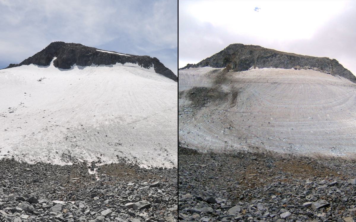
Ghiacciaio Lyell, Yosemite National Park (1883-2015)
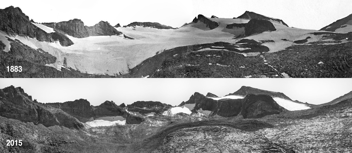 U.S. National Park Service. 1883 photo: USGS/Israel Russell. 2015 photo: NPS/Keenan Takahashi
-
Ghiaccio Antartide
 Earthshots: Satellite Images of Environmental Change, U.S. Geological Survey.
-
Lago Etang Saumatre, Haiti
 Thematic Mapper sensor onboard Landsat 5 and the Enhanced Thematic Mapper Plus onboard Landsat 7
-
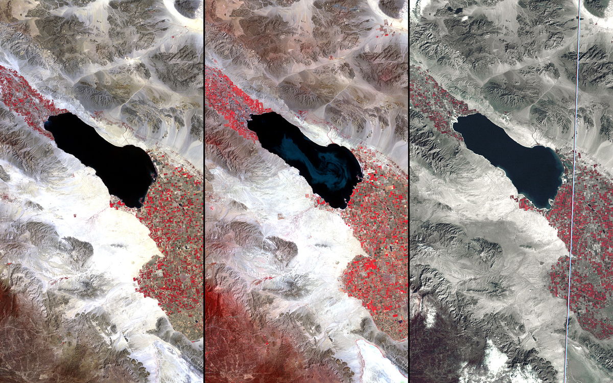
Salton Sea, california
 U.S. Geological Survey (USGS) Landsat Missions Gallery “The Salton Sea,” U.S. Department of the Interior / USGS and NASA
-
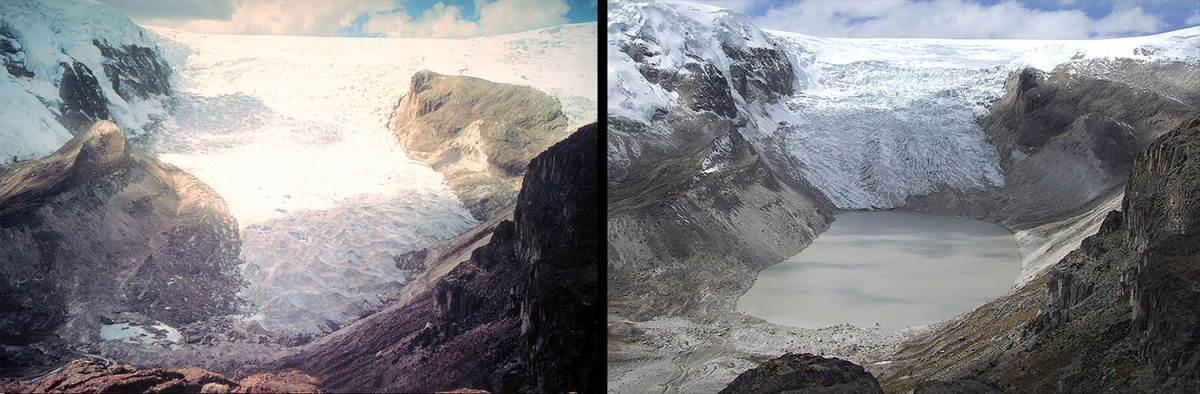
Ghiacciaio Qori Kalis, Peru
 Dr. Lonnie G. Thompson, Distinguished University Professor, Byrd Polar and Climate Research Center, The Ohio State University
-
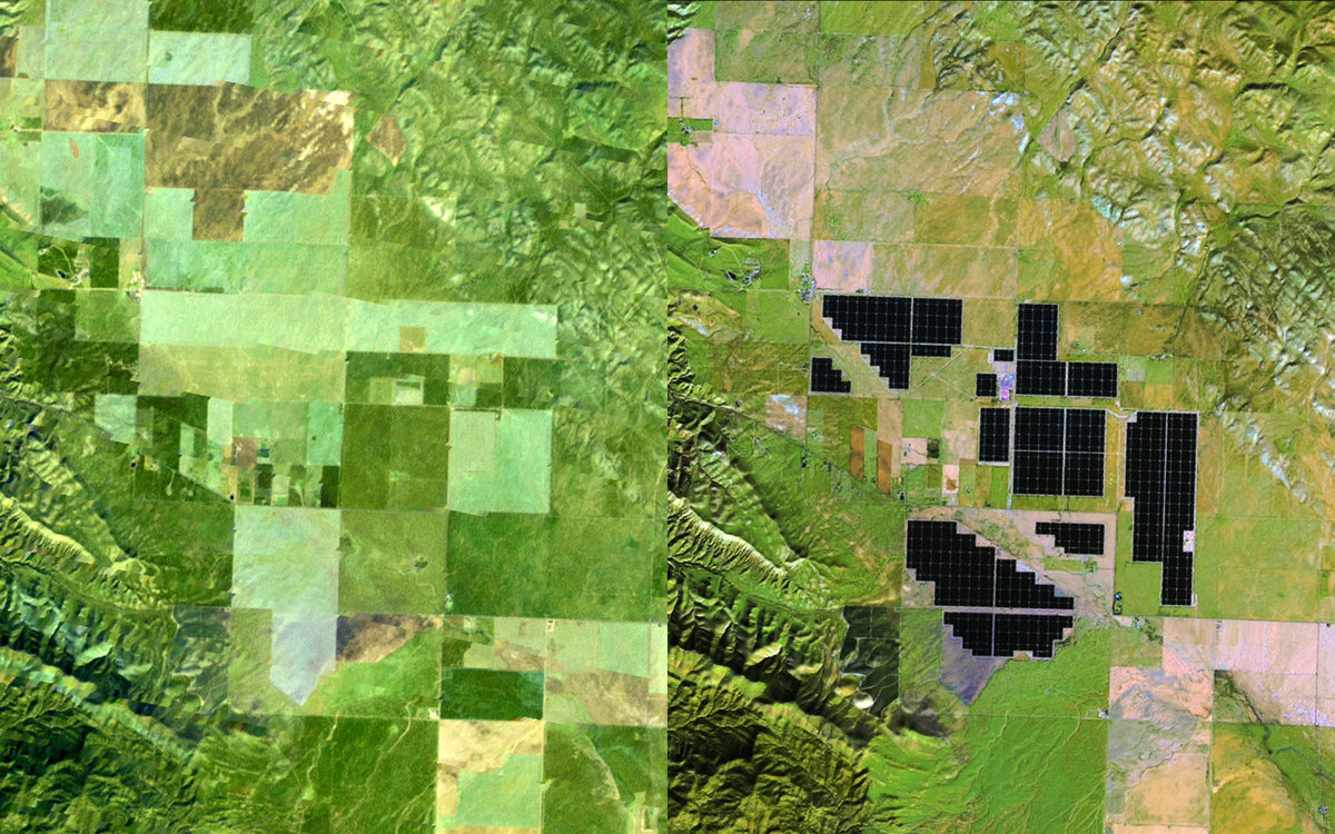
Topaz Solar Farm, California
 U.S. Geological Survey (USGS) Landsat Missions Gallery “Topaz Solar Farm, California,” U.S. Department of the Interior / USGS and NASA
-
Delta Mississippi, Louisiana
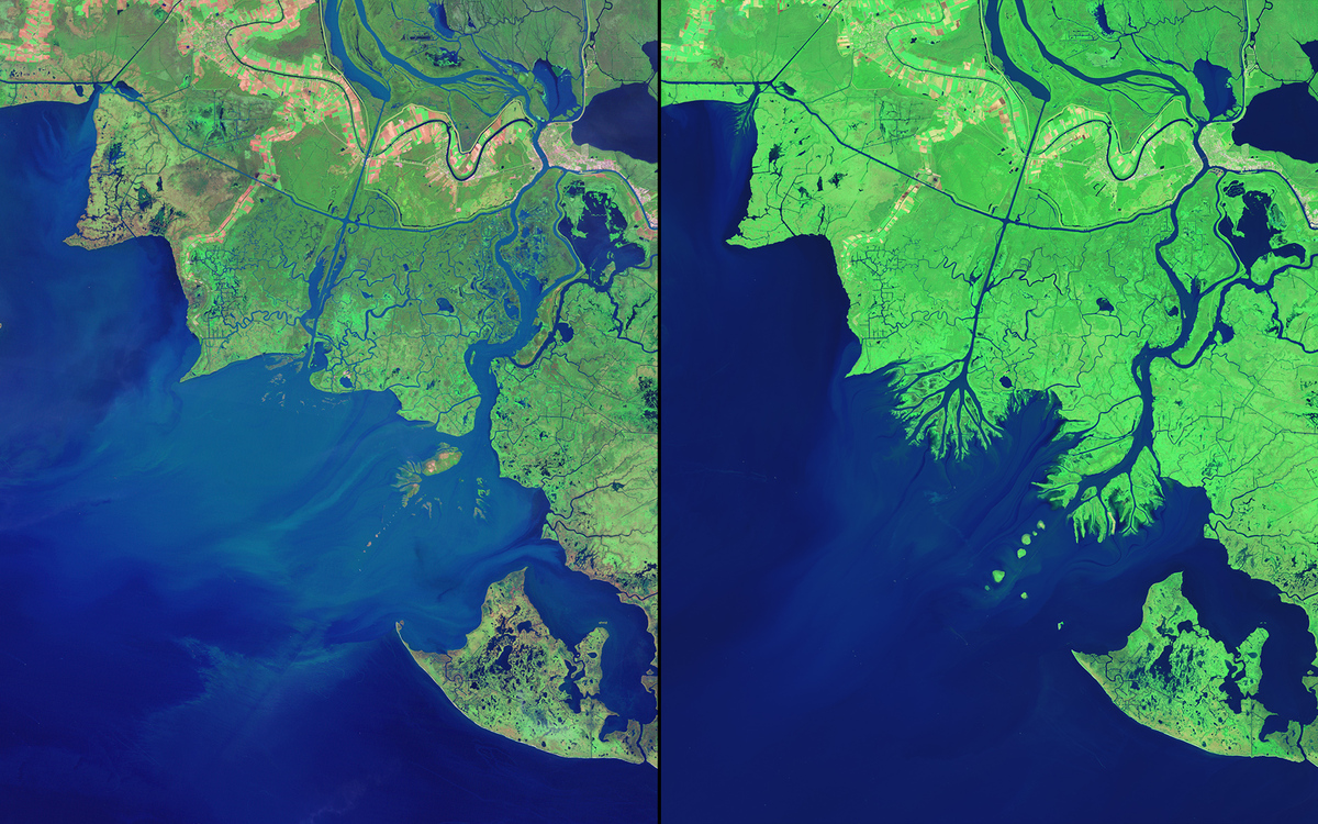 NASA Earth Observatory using data from the U.S. Geological Survey.
-
Incendi Australia
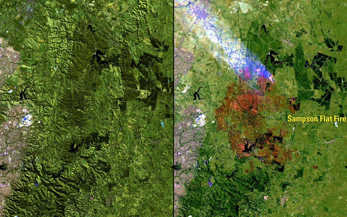 U.S. Geological Survey (USGS) Landsat Missions Gallery “Sampson Flat Fire, Australia,” U.S. Department of the Interior / USGS and NASA.
-
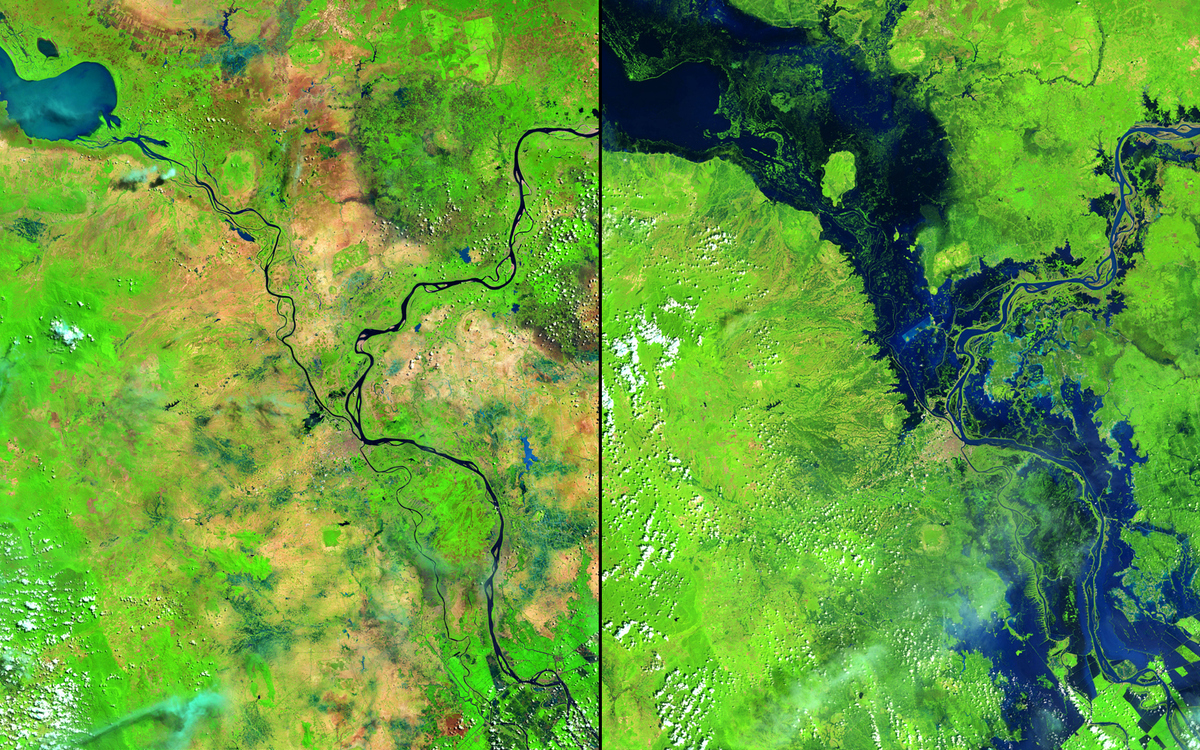
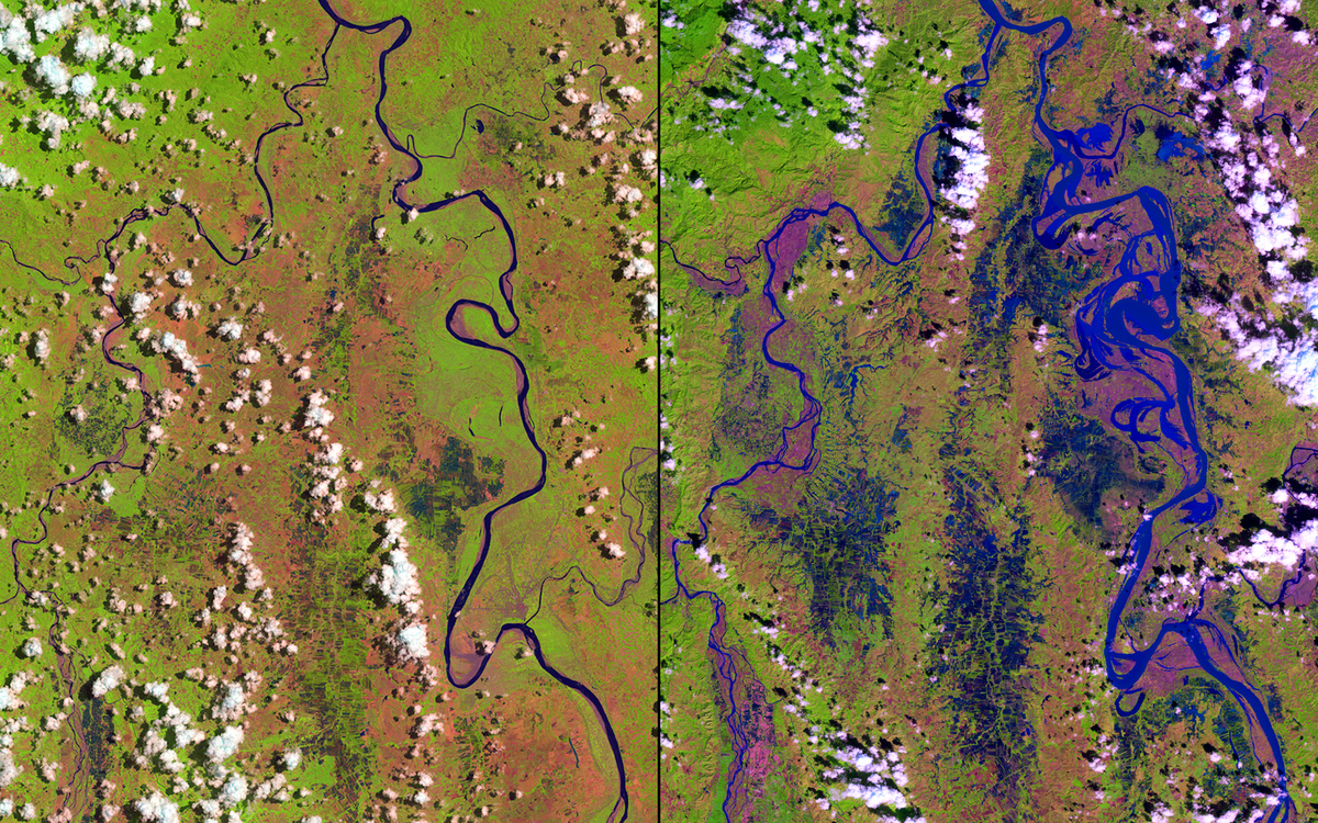
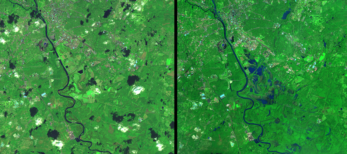
Inondazione, Mozambico
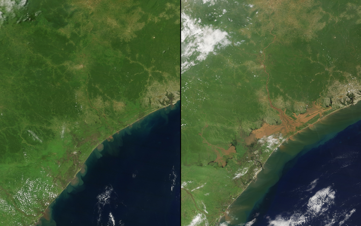 NASA’s Earth Observatory
-
Eruzione lavica Vatnajökull, Islanda
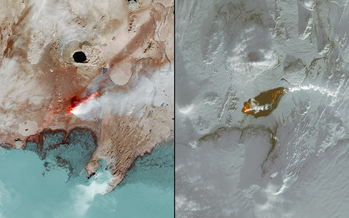 NASA Earth Observatory
-
Deforestazione Kenya
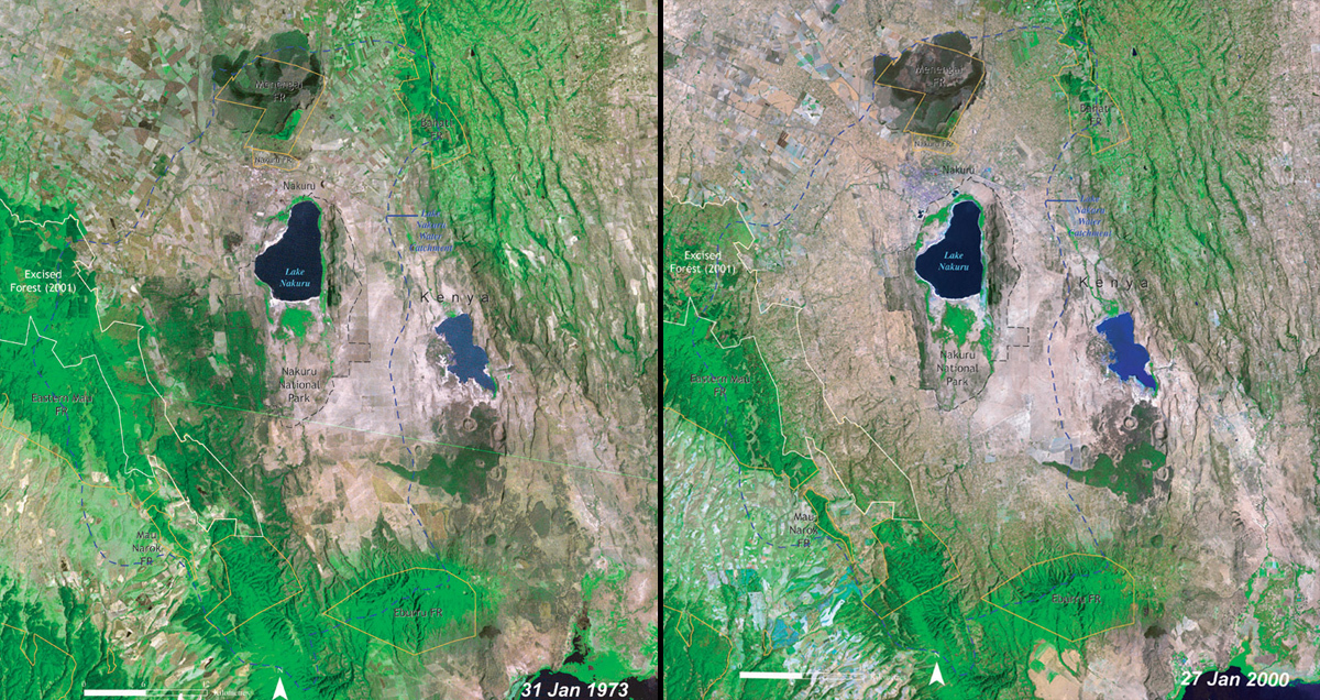 United Nations Environment Programme (UNEP). From Kenya Atlas of our Changing Environment (2009); Division of Early Warning and Assessment (DEWA), UNEP, Nairobi, Kenya